Exploring the Parks and Nature Areas Around Sioux Falls

Sioux Falls has 76 named parks throughout the city that range from small sites suitable for neighborhood gatherings and playgrounds to large well developed nature centers such as Great Bear Recreational Park, Arrowhead Park, the Wegner Arboretum and East Sioux Falls Historical Site, and the linked park system along the Big Sioux River. The state provides outdoor recreation areas and state parks including the Big Sioux Recreation Area, Beaver Creek Nature Area, Lake Alvin Recreation Area, Newton Hills State Park, and the Outdoor Campus in Sioux Falls that is a joint city/state operation.

Tuesday, November 26, 2013

Arrowhead Park in the Early Winter


This is an especially interesting time to go out to Arrowhead Park in Sioux Falls for a stroll around the quarry ponds to view the geese and ducks who have decided to remain in our area during the winter. 
The ponds have aerators to keep a portion of the surface ice free, and the city parks department spreads corn kernels along the shore within the park for their dining pleasure. In addition, visitors distribute corn and other food to the birds at the pond nearest the parking lot at the entrance.  
So, hundreds of geese and ducks, maybe thousands, gather throughout much of the winter and present quite a show for visitors.
For the past few years, the parks department has kept the paved trail that runs through the park open from the parking lot along far east 26th Street to the Wallace Dow designed barn. 

The trail along the back section of the park has not been cleared in years past, but perhaps this may come to pass at some point in the future.  For now, however, the snow has melted, and the trail throughout the park is clear of snow and ice.
There is not a lot of traffic along the trail at this time of year.  For the past few days, my wife and I have bundled up and made the 30-minute hike on sunny afternoons.  The temperatures have not been too cold – in the 20s and 30s - but the wind can be uncomfortable.
As they say, though, there is no inclement weather; there is only inappropriate dress. If we dress for the weather, most of us will be fine strolling throughout the winter. 


Friday, September 20, 2013

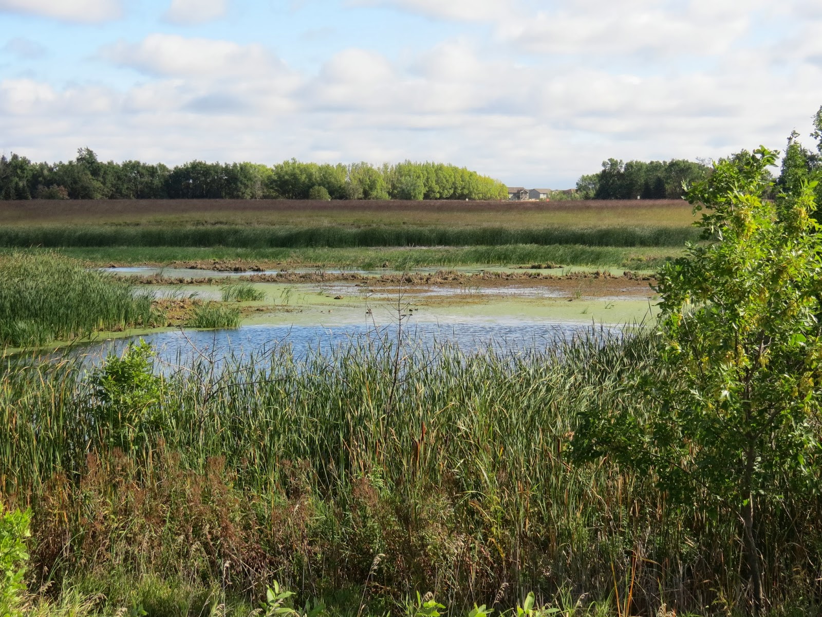
Atkins Slough WPA - Sept. 2013


Atkins Slough WPA (Wildlife Production Area) was recently described in the Sioux Falls Argus Leader as a good spot for bird watching.  This was a new site for me, and I decided to check it out today.
Atkins Slough is on the west side of Tea, just behind and across a gravel road from Tea High School and a few miles southwest of Sioux Falls.
A parking area is provided at the entrance to the WPA, and the nature trail leads west toward and around Atkins Slough.
The trail is only about a mile roundtrip over a wetlands area and offers the chance for good bird watching as well as a close look at the varied trees, bushes, and grasses that make up a wetland environment.
The trails were obviously well designed, although seemingly little used.  There are long stretches of nicely graveled trails alternating with overgrown sections.  Sometimes the grasses and other plants are growing across the trail, although it is not difficult to follow.
Two wooden bridges provide elevated passage over especially low portions of the trail. 
A major effort has been made to include good interpretation through signage along the route. 
The slough itself forms the centerpiece of the area; the trail leads through the grasses and tree cover to the shore of the slough.  Several benches are provided along the trail where a person might sit quietly and observe the bird life of the area.
On my walk through the WPA today, I was conscious of the changing seasons evident now in the last half of September.  Some of the trees and other plants are changing colors, mostly to a yellow tone.
A trail of only a mile in length might not seem as much a hike as a stroll through nature.  Perhaps going to Atkins is more of a nature walk than an actual hike.  My walk this morning took me about 40 minutes, including time to stop and appreciate the moment and take some photos. Probably bird watching would be a good reason to stroll this trail in search of wetlands birds, critters, and flora.
Signage cautions hikers that this is also a public hunting area and caution should be exercised during hunting season.  During my time in the WPA, I was alone with no sign of anyone else in the area.
I recommend taking this walk through the Atkins Slough wetlands.  If hiking were to be the objective, it might be best to do Atkins and another site on the same occasion.  A good deal of care was used to create this hiking possibility – signage, groomed trails, bridges and an elevated walkway, and a parking area.
The directions offered in the newspaper were to go south on Interstate 29 to the Tea Exit (Exit 73), turn right onto 271st Street for 2.5 miles, and then turn left onto 468th Avenue for .5 miles to a gravel parking lot on the right side of the road.
I followed those directions and found that some amplification is needed.  First, 271st Street is not named until passing through the northern part of Tea; the 2.5 miles is fine, but don’t be concerned with not seeing that designation for a while.  Then, I found no signage for 468th Avenue and drove a couple more miles west until turning around to backtrack.  My recommendation at this point is to drive the 2.5 miles west on 271st Street to the intersection where the pavement stops and then turn left on the unnamed gravel road for half a mile.  The parking area for the nature trail is on the right (west) side of the road.  The back of Tea High School is on the east side of that road, and the parking area for the Wildlife Production Area and the nature trail is just to the west, within sight of the school.  There are several signs identifying the nature trail just off of the parking area.
A complete set of my photographs of Atkins Slough can be found on my Flickr account at the following URL: http://www.flickr.com/photos/jayheath/sets/72157635697988504/

Monday, July 22, 2013

Good Earth State Park at Blood Run: July 2013


We haven’t been out to Good Earth State Park at Blood Run this season, and we wanted to see the effect so far of its designation as the newest South Dakota state park.  The official dedication of the park was last week, and the news coverage was very optimistic about a future that would also include the Iowa portion of the site just across the river.  At this point, the South Dakota site includes about 600 acres.  Much of the archeological remains of the Indian tribes that lived in the area are located on the Iowa side.
Good Earth seems about as it was last year when we roamed throughout its trails.  The entry area has a few more picnic tables, the vault toilets have been relocated across the road, and the signs have changed to reflect the new designation and name change. The area through which the trail enters the park was a cornfield last year. The corn was not replanted, apparently, and that land is now grassland.
There were three other parties hiking through the area as we arrived; in terms of our experiences along area nature area hiking trails on a weekday morning, that was a crowd!  A group hike to Great Bear has become a popular activity.  The park is only a few miles southeast of Sioux Falls.  We can reach the park in less than 15 minutes from our eastside Sioux Falls home.
We left home under cloudy skies with a temperature in the high 70s; in the 15 minutes it took us to arrive at the park, the clouds has dissipated, the sky was sunny, and the temperature had climbed into the 80s.
The trail leading into the park moved through open grassland for the first half-mile or so.  It was too hot for our little seven-pound miniature poodle now into his sixteenth year and dealing with deafness, cataracts, and congestive heart failure.  I had to carry him through the grassland trail until we entered the shade of the forest.  Once in the shade, though, he was fine.
As we moved along and into the woods, our first stop was the vista looking over the Big Sioux River.  This is a magnificent view, and I look forward to standing at that spot, looking up and down the river from the top of a high cut-bank.  I thought of how many times I have passed by this site looking up from the cockpit of my kayak on a cruise from the Big Sioux Recreation Area at the edge of Brandon to the Grandview Bridge, across from Lake Alvin.
There are about two miles of hiking trails through Good Earth.  About half of the hike can be in the sun and the other half in deep or dappled shade.  The trails wind up and down hills and the slopes are pretty gentle. 
The view out over the river from the heights of the bluff and a short trail in the northern part of the park that leads down to the river shore are favorite spots of mine. The forests, of course, are the highlight of the park, and it is reflective to look into the depths of thickly wooded forests with some trees estimated at 200 years old.  Much of this landscape is largely unchanged over that time.
An old barn marks the conclusion of the trail if moving in a counterclockwise direction.  There are picnic tables, a water fountain, and vault toilets just off the parking lot.
There have been a series of guided nature hikes held in the park this summer, and these will continue through August.  Joining one of these hikes requires registration through the Outdoor Campus at http://www.outdoorcampus.org, and then selection for the Sioux Falls campus.  My wife and I took a guided hike through the park last year, and we learned a great deal about the geology, natural history of the area, and identification of various plant life.
The narrative and photos of a walk through the park last fall can be found on the area hiking possibilities listed on the right side of the blog.
A full set of photographs of this hike can be accessed at my Flickr account: http://www.flickr.com/photos/jayheath/sets/72157634749447833/