Exploring the Parks and Nature Areas Around Sioux Falls

Sioux Falls has 76 named parks throughout the city that range from small sites suitable for neighborhood gatherings and playgrounds to large well developed nature centers such as Great Bear Recreational Park, Arrowhead Park, the Wegner Arboretum and East Sioux Falls Historical Site, and the linked park system along the Big Sioux River. The state provides outdoor recreation areas and state parks including the Big Sioux Recreation Area, Beaver Creek Nature Area, Lake Alvin Recreation Area, Newton Hills State Park, and the Outdoor Campus in Sioux Falls that is a joint city/state operation.

Thursday, July 11, 2013

Beaver Creek: Summer 2013


For the first time this summer, we went out for a hike at the Beaver Creek Nature Center, located about midway between Rowena and Brandon, or about 10 miles northeast of our eastside Sioux Falls home.  We have been hiking in this area for over 30 years, and it is one of our favorite spots for a nice walk in the woods.
 While Beaver Creek Nature Center is a state-owned property, a park entrance sticker is not required.  The nature center is centered along Beaver Creek and includes a varied landscape of heavily wooded forest, the creek itself as it flows along, open upland meadows, a lowland flood plain, and trails that wind through the hills and over several bridges.
Much of our hiking this summer has been build around the needs of our seven-pound miniature poodle, Finnegan.  He is over 15 years old now and has struggled with congestive heart failure for the past few years.  In the summer, he can’t take the heat and intense sunlight anymore.  Even though he can walk two or three miles, we try to structure his walks with us so that we can avoid the heat of the summer day and walk in the shade.
 So, Beaver Creek in the morning is a very good choice for us, and for Finnegan.  The area is largely dappled shade with long sections of the trail in deep shadow. While there are also areas of direct sunlight, those sections of the trail pass quickly. This variety of sunlight conditions and the dirt trails are just right for all of us.
As usual, we started out at the parking lot on the left side of the lower section of the park. From the parking lot, we proceeded to the old swayback wooden bridge over Beaver Creek and turned right along the main trail heading downstream and into the woods paralleling the creek.
This section of the trail is mostly shade, some dappled and some deep shadow.  The trail continues along the creek and increases in elevation along a path reinforced in places with inset steps.
 As the path rises, it eventually reaches a ridgeline overlooking the lower park, and a hiker can backtrack above the creek to walk in an upland meadow with a view through the trees of the parking lot area. 
We generally walk along this path for 100 yards or so and then return along the main trail as it follows a slope above the forest leading through the upland meadows. 
After a couple hundred yards, the trail then moves down the slope to a swinging wooden bridge over a ravine that extends on the left side of the pathway.

Again, allowing for a quite varied landscape, the trail moves along through another upland meadow and then reenters the forest, emerging at a set of wooden steps leading down the hill to the lowland flood plain. 
Looking down from the top of the wooden steps into the dense lowland growth is one of our favorite views in the nature center. There is a primeval sense of jungle growth when viewed from above that stirs the imagination. 
 Moving down from above, we followed the trail back to Beaver Creek and along it back through another of the meadows to yet another bridge over the creek.
On the other side of the creek once again, we turned left and followed the path alongside a field of corn toward the cabin.
The Samuelson cabin is the centerpiece of the nature center.  The cabin was constructed in 1873 on an early homestead and serves as a living history memorial to the lives of early settlers.  For several decades now, there has been an annual “Homesteaders Day” celebrated in September, and my family has been attending these for more than 30 years.
After taking a “water break for Finnegan” rest, we retraced our way back along the trail through the woods to the parking lot where we began.
 Our hike today took us about an hour and a-half, with plenty of pauses for photography and a time spend at one of the picnic tables at the shelter by the cabin.
On our way back, a mink ran across the path and into the brush.  Our dog Finnegan was captivated by the smells, and we had a difficult time encouraging him to follow us rather than dash into the woods.  Of course, it would be too bad for Finnegan if he should tangle with a mink!
As is usually the case, the nature center was deserted this Thursday morning, and it remained so during the time of our visit. 
To check out Beaver Creek Nature Center during other seasons of the year, you can access the inventory of area hiking sites on the right side of the blog.  Click on Beaver Creek, and you will see earlier narratives and sets of photographs taken during other seasons.

Saturday, June 8, 2013

Mary Jo Wegner Arboretum/Perry Nature Area


 Yesterday, in between the seemingly constant rain, I went out to the Mary Jo Wegner Arboretum/Perry Nature Area on the east edge of Sioux Falls.  This is a site my wife and I visit twice a week for much of the year.  A lot of development in the arboretum has taken place over the past few weeks, and I wanted to capture the changes for those interested in hiking in this very accessible area.

An open house was held a couple of weeks ago for the Mabel and Judy Jasper Educational Center, which is at the heart of the current stage of development for the arboretum.  This building has a replica of a country school classroom, several program rooms, and will serve as the centerpiece for the arboretum.  We attended the open house and were able to savor the upbeat spirit of those key people who spearheaded the creation of the arboretum.

At the moment, there is some concrete work and landscaping taking place in the front entrance area of the center and on the slope behind the building leading down toward the Big Sioux River.  Yesterday, a crew was placing trees along the lower slope and out toward the flatland leading down across the field and tree line toward the river shoreline.

As usual, Finnegan and I headed east along the old rail bed heading toward the river as it bends south under Highway 42.  In years past, this trail was not maintained during the summer, and the grass grew too high for easy passage.  That has all changed since developmental of the arboretum.  The grass is mowed, forming an easy hiking trail that continues down to the entry road leading to the Fraternal Order of Police building. 

It seems obvious that the FOP building is no longer an isolated structure east of town; now, it is right in the middle of a developing nature area and seems misplaced.  It is an island of property that seems incongruous today.

We continued along the old field road that runs east/west and connects back on the main circuit of gravel road that winds through the Perry Nature Center portion of the arboretum.

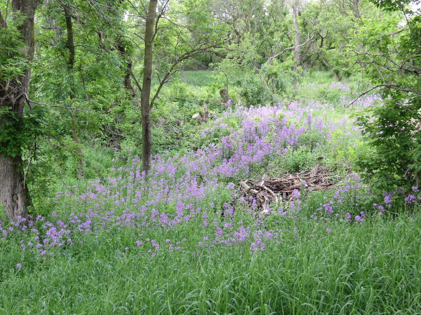
A major reason for our hike yesterday was to enjoy the remarkable profusion of purple phlox that is scattered throughout the area.

The phlox is seen in clumps within the grasses and out into the trees.  My wife and I have enjoyed this growth for many years, and the arboretum has many swaths both within the Perry Nature Center portion and in the developing arboretum.  We first became aware of the attractive phlox on walks through the Perry Nature Center in years past.

Continuing along the gravel road leading through the Perry portion, we passed the lower picnic shelter, crossed over the small creek flowing through, and moved into the woods as we followed the trail past foundations of the old homes that made up East Sioux Falls.
Looking at the remains of homes that once formed the community of East Sioux Falls evokes a past when this was a vibrant town filled with energy and hope.  A brief history of East Sioux Falls is offered in the historical displays within the arboretum.

The trail heads west until climbing up from the lowlands and entering on to the old rail bed again heading east.

We continued west down the rail bed trail, passing more stands of purple phlox. 

The trail then intersects with the entrance road into the arboretum, and we headed back to the Jasper Educational Center, where the car was parked. 

After stopping to again observe the landscaping work in progress, we departed after an hour of hiking through the area.

My full set of photographs of the hike yesterday can be found on my Flickr page at the following URL: http://www.flickr.com/photos/jayheath/sets/72157634009830033/

A set of past narratives and photographs from earlier postings about the arboretum can be found on the menu located on the right side of the blog.

Sunday, May 26, 2013

Spirit Mound Historic Prairie


For many years I was a professor at the University of South Dakota and made a nearly daily commute between Vermillion and Sioux Falls.  Sometimes to fight sleep and to bring some novelty into the drive, I would take the secondary roads and avoid the Interstate.  State Highway 19 out of Vermillion across the Vermillion River and heading north towards Centerville is one of secondary paved roads that I occasionally used, but I never recognized Spirit Mound just six miles north of the USD campus.  It took the celebration surrounding the 200th anniversary of the Lewis and Clark expedition alert me to the existence of Spirit Mound.

Yesterday morning I drove down to Yankton to observe and photograph the departure of 129 kayaks and canoes as the South Dakota Kayak Challenge got underway.  On the way back to Sioux Falls, I decided to turn north at Vermillion and return on Highway 19 to visit Spirit Mound.
Going north, Spirit Mound Historic Prairie is located just six miles north of Vermillion on the west side of the highway.  Passing over the Vermillion River, the landscape is flat farmland.  Spirit Mound is a glacially formed geological anomaly that drew Lewis and Clark up from their journey on the Missouri River in 1804 for the panoramic view of prairie and wildlife.  They had heard Native American tales of tiny spirit people who inhabited the hill. The site continues to have a spiritual significance to many Indian people.
Spirit Mound restoration was a project of a local conservation group and the state and federal governments that came to fruition in 2001.  The park covers 320 acres and includes a developed trail that leads from the parking lot across the prairie, around the mound and up to the summit. Interpretive signage along the trail offers historical and geological information to visitors. The trail is designated as a National Recreation Trail by the federal government. 
There is a small park on the south end of a parking lot with a picnic table and vault toilet.  The trail leads north from the park for .8 miles, approaching Spirit Mound from the south and climbing around the hill to a final assent to the summit on the north side. The total hike is about 1.6 miles over a landscape with no shade and no water.  The trail is well designed so that inclines are gradual and the surface easy for most hikers.  I saw families with small children, even a mother pushing a baby buggy up the trail.
The prairie along the way is composed of native grasses and has a population of perching birds often found on grasslands.  It is a pleasant walk with a gradually broadened view of the landscape.  There are benches located at intervals for those needing a rest or desiring a moment of contemplation. 
The summit of the hill has a panoramic view over the landscape.  The DakotaDome at the University of South Dakota, about seven hills off, is visible to the south.  Farmland instead of bison herds now surround the site and provides a great view of current land usage.
Spirit Mound is about 60 miles south of our eastside Sioux Falls home.  It is an easy spot to visit when returning from Yankton or Vermillion.  If I were visiting the site from Sioux Falls, I think it would be good to leave early in the morning to avoid the heat and strain of climbing under the summer sun.  It would be good to leave Sioux Falls about 6:30 a.m. or so, drive an hour to reach the site, spend an hour on the hike, and then stop for breakfast in Centerville or another small town.  There are also a couple of great museums in Vermillion that might be visited on the same trip: The National Music Museum on the campus of USD and the W.H. Over Museum located on the north side of Vermillion.  I’m so glad that I have finally visited Spirit Mound and heartily recommend the trip.

There are several excellent websites about Spirit Mound, and I suggest that a prospective visitor review them prior to making the trip: http://en.wikipedia.org/wiki/Spirit_Mound_Historic_Prairie