 |
| South Entrance - the best place to enter the preserve |
Gitchie Manitou State Preserve is located just to the east
of Sioux Falls, across the Big Sioux River. To reach this 91-acre preserve, my preferred route is to
drive east out of Sioux Falls along 26th Street and join Highway 42
just past Arrowhead Park. Just
after crossing the bridge over the Big Sioux River, take the first paved road
to the right (115) and continue south.
This road becomes 481st Avenue and continues to a sharp left,
where the road becomes 268th Street. At that sharp turn, there is a limited space to park a car,
and the north entrance to the preserve leads off into the wooded area as a
foot-path.
 |
| Parking Lot for the South Entrance |
A better way to enter the preserve is to continue on the
paved road (268th Street) around the curve where it becomes Adams
Avenue and continues south. Just a
mile or little more, the north entrance to the preserve is clearly marked on
the right side of the road. There
is a parking lot, a large sign, and a clearly indicated pathway into the
preserve. Past the entrance to the preserve, the road continues on to the
village of Granite and then leads on to the Grandview Road back over the Big
Sioux River to the highway past Blood Run and back into Sioux Falls. I have searched for the main entrance
to Gitchie Manitou on previous occasions and had difficulty locating it. If you follow the directions above, it
should be fairly easy. The total
distance from our home near Sycamore and 26th Street is about six
miles or so and takes less than 15 minutes.

Entering from the south entrance, the trail leads along a
relatively open prairie area with the woodlands off to the left. The trail follows the course of the Big
Sioux River; at times it runs along the bank and other times it is separated by
a swath of heavy woodland growth.
The first section of the trail, perhaps a mile or so in
length, is through this open area.
The next section passes through a canopy of trees that extends for most
of the remaining distance of the trail.
Again, the east bank of the Big Sioux River is off to the left. As the hiker moves closer to the tree
cover, there are trails that also lead off to the right (east) through Sioux
quartzite outcroppings.
One pathway leads back into the woods to a large ruined
quartzite stone structure. The
structure is intact and includes a large fireplace. It seems as though it must have served as some sort of lodge
in the distant past.
Beyond the turn-off to the structure, there is another
pathway that leads off to the right to a water-filled quarry that looks like a
smaller version of the quarry lagoons at Arrowhead Park. It seems obvious that this was a
quartzite mining quarry long ago that filled with water from rain and melting
snow. It is easy to follow a
pathway up to the rim of the quarry.
Of course, if you enter at the north end, the directions
would be reversed, but I advise driving on the extra couple of miles to the
south gate.
The trail through Gitchie Manitou is level and an easy
hike. There is lots of bird life,
especially in the trees that extend back to the river bank.
There are occasional excellent views of the Big Sioux River
as it makes its way south along the border between South Dakota and Iowa.
Gitchie Manitou is in close proximity to Blood Run and
shares a long history of use by Native American people. The landscape includes
native prairie grasses, Sioux quartzite rock formations, the Big Sioux River,
woodlands, and a great variety of plant life. We also saw many species of birds flitting in the trees of
the woodlands and soaring in the skies above.
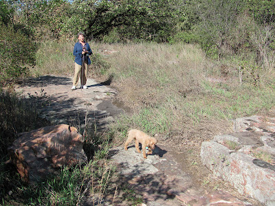
We spent about two hours doing a leisurely hike through the
preserve, beginning at the rougher north end, exploring the quarry lagoons and
the quartzite structure, and walking to the south entrance before returning to
our starting point. Our little seven-pound, 14 year old miniature poodle kept
up with us just fine. We felt that
perhaps we had neglected this hiking option so close to Sioux Falls and plan on
returning a couple more times this fall.
It is a public hunting area, though, so I would be careful during
pheasant season!
We did not see anyone else in the preserve during our two
hours. This is really a prime
hiking site within our area!
 |
| The North Entrance - the less preferred entrance |
There is a darker side to Gitchie Manitou.
In November of 1973, this was the site
of a mass murder, one of the worst in Iowa history.
Five teenagers from Sioux Falls were camping in the preserve
and were attacked by three brothers, strangers to the victims, also from South
Dakota.
Four of the teenagers were
murdered and the fourth assaulted.
The three brothers were all convicted and sentenced to life in an Iowa
prison without possibility of parole.
For those interested in viewing the complete set of photos from this hike, please access my Flickr account at the following URL:http://www.flickr.com/photos/jayheath/sets/72157631100013776/detail/


Thanks for sharing your experience on this hike. My 1 1/2 year old yellow lab an I enjoyed a beautiful day exploring and your blog helped me find my way when google maps let me down.
ReplyDelete