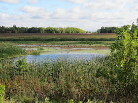
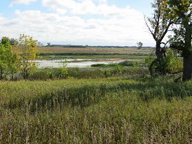
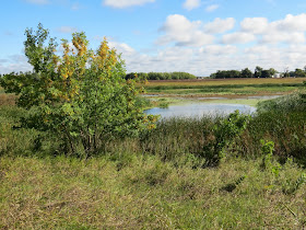
Atkins Slough WPA (Wildlife Production Area) was recently
described in the Sioux Falls Argus Leader as a good spot for bird
watching. This was a new site for
me, and I decided to check it out today.
Atkins Slough is on the west side of Tea, just behind and
across a gravel road from Tea High School and a few miles southwest of Sioux
Falls.
A parking area is provided at the entrance to the WPA, and
the nature trail leads west toward and around Atkins Slough.
The trail is only about a mile roundtrip over a wetlands
area and offers the chance for good bird watching as well as a close look at
the varied trees, bushes, and grasses that make up a wetland environment.
The trails were obviously well designed, although seemingly
little used. There are long stretches
of nicely graveled trails alternating with overgrown sections. Sometimes the grasses and other plants
are growing across the trail, although it is not difficult to follow.
Two wooden bridges provide elevated passage over especially
low portions of the trail.
A major effort has been made to include good interpretation
through signage along the route.
The slough itself forms the centerpiece of the area; the
trail leads through the grasses and tree cover to the shore of the slough. Several benches are provided along the
trail where a person might sit quietly and observe the bird life of the area.
On my walk through the WPA today, I was conscious of the
changing seasons evident now in the last half of September. Some of the trees and other plants are
changing colors, mostly to a yellow tone.
A trail of only a mile in length might not seem as much a
hike as a stroll through nature.
Perhaps going to Atkins is more of a nature walk than an actual
hike. My walk this morning took me
about 40 minutes, including time to stop and appreciate the moment and take
some photos. Probably bird watching would be a good reason to stroll this trail
in search of wetlands birds, critters, and flora.
Signage cautions hikers that this is also a public hunting
area and caution should be exercised during hunting season. During my time in the WPA, I was alone
with no sign of anyone else in the area.
I recommend taking this walk through the Atkins Slough
wetlands. If hiking were to be the
objective, it might be best to do Atkins and another site on the same
occasion. A good deal of care was
used to create this hiking possibility – signage, groomed trails, bridges and
an elevated walkway, and a parking area.
The directions offered in the newspaper were to go south on
Interstate 29 to the Tea Exit (Exit 73), turn right onto 271st
Street for 2.5 miles, and then turn left onto 468th Avenue for .5
miles to a gravel parking lot on the right side of the road.
I followed those directions and found that some amplification
is needed. First, 271st
Street is not named until passing through the northern part of Tea; the 2.5
miles is fine, but don’t be concerned with not seeing that designation for a
while. Then, I found no signage
for 468th Avenue and drove a couple more miles west until turning
around to backtrack. My
recommendation at this point is to drive the 2.5 miles west on 271st
Street to the intersection where the pavement stops and then turn left on the
unnamed gravel road for half a mile.
The parking area for the nature trail is on the right (west) side of the
road. The back of Tea High School
is on the east side of that road, and the parking area for the Wildlife
Production Area and the nature trail is just to the west, within sight of the
school. There are several signs
identifying the nature trail just off of the parking area.
A complete set of my photographs of Atkins Slough can be
found on my Flickr account at the following URL: http://www.flickr.com/photos/jayheath/sets/72157635697988504/


No comments:
Post a Comment